
Create the area
Draw a shape or select a recognised boundary, then choose the property types to include.

Map the properties affected by a project, understand the area and arrange print and delivery from one workspace




























Engage replaces disconnected maps, address-count spreadsheets and separate print enquiries with a guided four-step process.
Draw a shape or select a recognised boundary, then choose the property types to include.
Select the item, specification and options such as envelopes, then upload your document.
Choose the delivery service, an available date and your own campaign reference.
Check the complete job in one summary before anything is committed to production.
Use a precise custom shape, a fixed distance from a point or a buffer around a route. Each tool immediately returns the addresses inside the selected area.
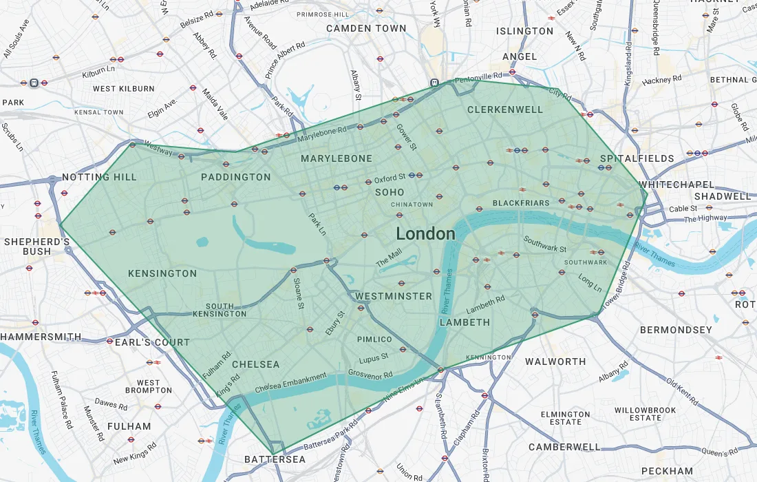
Trace a custom project or consultation boundary, point by point, around the exact area affected.
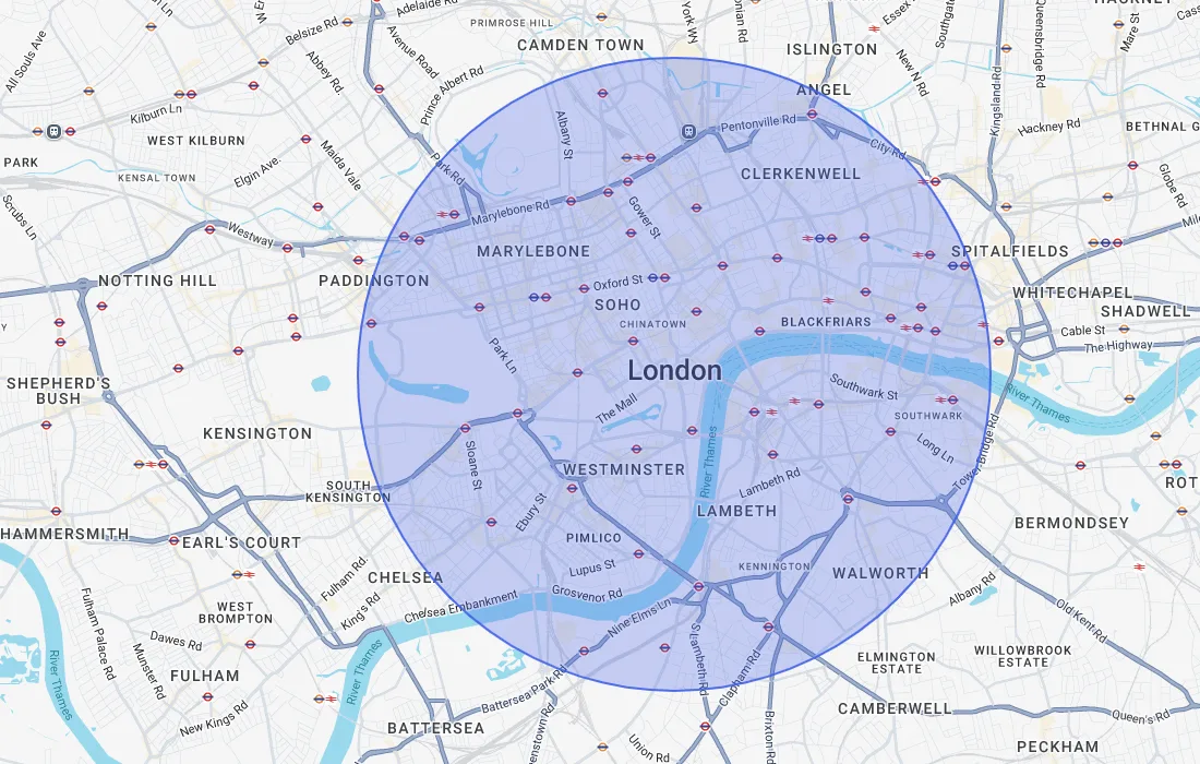
Create a consistent catchment around a single point, useful where a set distance has to be evidenced.
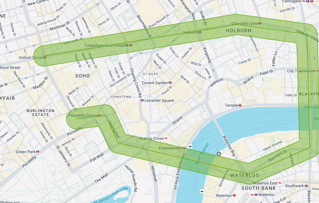
Follow a road, route or linear scheme and capture the properties within a set distance either side.
Display a dot for every address so teams can visually check coverage before anything is printed or delivered. Counts are separated into residential, commercial and total addresses for every shape.
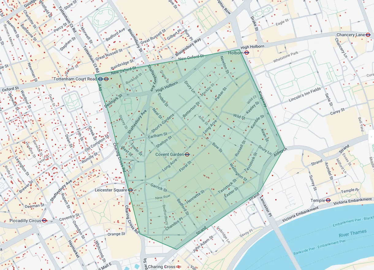
Select a recognised geographic or administrative boundary instead of tracing it manually. Engage works with postcode sectors, wards, parishes, council areas and constituencies, and returns the address counts straight away.
Start Mapping →Turn on political data to identify relevant ward councillors and view useful contact details within the mapped area. It gives stakeholder and consultation teams a faster starting point for local engagement planning.
Political data is optional and can be switched on only when it is useful to the project.
Name each shape, choose its colour, switch between filled and outline views, and review the residential, commercial and combined totals. This makes multi-area projects easier to understand and share.
Engage is designed around practical resident and stakeholder communications, not generic map drawing.
Everything from mapping an area to submitting the finished job.
Prefer a walkthrough? Book a demo →
Engage is a community engagement delivery platform. It helps teams define an area, calculate the properties within it, prepare print and choose a delivery service in one guided workflow.
You can draw a custom polygon, create a fixed radius, build a buffer around a route or select a recognised boundary such as a postcode sector, ward, parish, council area or constituency.
Engage shows residential, commercial and total address counts for each shape and across the complete map. Address dots can be displayed to help check coverage visually.
Yes. You can choose the print item and specification, add options such as envelopes, upload your document, select an available delivery service and review the full job summary before submitting.
Yes. Optional political data can show relevant ward councillors and useful contact information within the selected area, helping teams understand the local stakeholder landscape.
Start with a free Engage account or arrange a short demonstration using one of your own projects.